Buyers who grew up in the Wyoming Valley know the names Agnes and Lee. Buyers moving in from somewhere else often do not, and the difference between two houses a mile apart along the Susquehanna can be the difference between no flood insurance requirement at all and a policy the lender will insist on before closing. This guide walks through the levee, the maps, the insurance rules and the history, with the sources for each.
The Wyoming Valley Levee
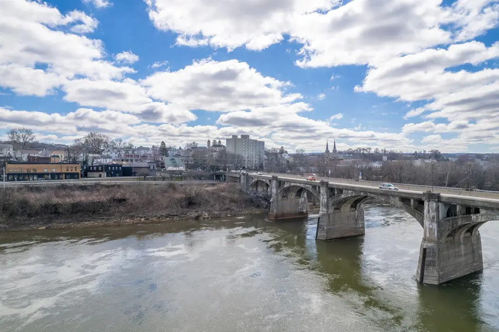
The levee system along the Susquehanna was built by the U.S. Army Corps of Engineers after the flood of March 1936 and is operated by the Luzerne County Flood Protection Authority. It runs about 16 miles of levees and floodwalls, with 78 drainage structures, 20 closure structures and 13 pump stations. The Corps lists the communities it protects as Wilkes-Barre, Hanover Township, Plymouth, Kingston, Edwardsville, Forty Fort, Swoyersville and Exeter.
After Tropical Storm Agnes in 1972, the system was raised in the early 2000s, three to five feet along about 15 miles, to protect against a flood the size of Agnes. In September 2011 Tropical Storm Lee pushed the river 1.75 feet above the Agnes crest, and according to the Corps the levees performed as designed, with no overtopping. Improved properties in the area the 1972 Agnes flood reached pay an annual levee fee to the Flood Protection Authority, $63.43 for a residence with an improvement assessment under $100,000 and $126.87 at $100,000 or more.
Towns the Levee Does Not Protect
Not every river town is behind the levee. In 2011 the river flooded more than a quarter of West Pittston and damaged nearly 900 homes there, according to the county, and the village of Mocanaqua in Conyngham Township was also hit hard. The Associated Press reported at the time that several hundred West Pittston homes were under water and about 80 homes and businesses were swamped in Plymouth Township.
The National Weather Service describes what floods at each stage of the river at the Wilkes-Barre gauge. These are its descriptions, useful for understanding which neighborhoods feel the river first.
| Wilkes-Barre Gauge | What the Weather Service Says Begins to Flood |
|---|---|
| 22 Feet, Flood Stage | Lowlands in Plainsville, Plymouth Flats, West Nanticoke and Shickshinny |
| 24 Feet | Lowlands in Pittston |
| 29 Feet | River Road in Port Blanchard and West Pittston |
| 31 Feet | Hollenback Park in Wilkes-Barre, Duryea and West Pittston |
| 35 Feet | The Dundee Area of Hanover Township and U.S. Route 11 in Edwardsville |
| 41 Feet | Maximum Effective Design of the Levee Protecting Wilkes-Barre |
Selected crests from the Weather Service's record for the gauge, including the five highest.
| Flood | Crest at Wilkes-Barre |
|---|---|
| Tropical Storm Lee, September 2011 | 42.66 Feet, the Record |
| Tropical Storm Agnes, June 1972 | 40.91 Feet |
| September 1975 | 35.06 Feet |
| Tropical Storm Ivan, September 2004 | 34.96 Feet |
| January 1996 | 34.45 Feet |
| June 2006 | 34.14 Feet |
| December 2023, the Most Recent Flood | 22.51 Feet |
What the Flood Maps Show
FEMA's current Flood Insurance Rate Maps for Luzerne County took effect on June 20, 2024 for most of the river communities, including Wilkes-Barre, Kingston, West Pittston, Pittston City, Pittston Township, Jenkins, Plains, Duryea, Exeter, Forty Fort, Swoyersville, Wyoming, West Wyoming, Hanover, Plymouth Borough and Township, and Shickshinny. Avoca and Dupont remain on maps from November 2, 2012. When we checked FEMA's map services on September 24, 2026, no newer preliminary or pending maps were listed for the county.
| Zone | What It Means |
|---|---|
| A or AE | Special Flood Hazard Area, a 1% or Greater Chance of Flooding in Any Year. AE Has a Mapped Flood Elevation |
| AE Floodway | The Channel and Adjacent Land Kept Open to Carry the Base Flood |
| X, Shaded | Moderate Hazard, Including the 0.2% Annual Chance Floodplain |
| X, Reduced Risk Due to Levee | Behind an Accredited or Provisionally Accredited Levee. Not a Special Flood Hazard Area |
| X, Unshaded | Minimal Hazard |
Land behind the Wyoming Valley levee is generally mapped as Zone X with reduced risk due to levee. Our spot checks of FEMA's map data in Wilkes-Barre, Kingston, Forty Fort, Swoyersville and Plymouth all returned it. That matters, because a lender is not required to make you buy flood insurance there. It does not mean the risk is gone. FEMA's current map data lists the Kingston to Exeter system as accredited and the Wilkes-Barre and Hanover Township system and the Plymouth system as provisionally accredited, under agreements dated in 2012. A 2014 Corps of Engineers evaluation found that those two systems had less extra height above the 1% flood than the Corps' own criteria call for. If you are buying behind either, ask the Flood Protection Authority about the current status.
To look up a specific property, use FEMA's Flood Map Service Center at msc.fema.gov or the Pennsylvania Flood Risk Tool at pafloodrisk.psu.edu. Two municipal details are worth knowing. FEMA shows no mapped special flood hazard area in Hughestown. And Slocum Township does not participate in the National Flood Insurance Program and has been sanctioned since November 2, 2013, which means federal flood insurance is not available there.
Flood Insurance and Your Mortgage
If the building is in a Special Flood Hazard Area in a community that participates in the program, federal law requires flood insurance on any loan from a federally regulated lender or backed by the federal government. The required amount is the lesser of the loan balance or the program's maximum, and lenders must also accept qualifying private flood insurance.
- Coverage. The National Flood Insurance Program insures up to $250,000 on a one to four family building and up to $100,000 on contents.
- Waiting period. A new policy normally takes effect 30 days after it is purchased, but the wait does not apply when the policy is bought in connection with making or increasing a loan.
- Price. Premiums have been set under FEMA's Risk Rating 2.0 method since October 1, 2021 for new policies and April 1, 2022 for renewals. By law most primary residences cannot see an increase of more than 18% a year.
- The seller's policy. A flood policy can be assigned to the buyer in writing when title transfers. Ask the seller early. An existing policy can be worth more than a new quote.
Four Luzerne communities earn a discount on flood insurance through FEMA's Community Rating System, for floodplain management that goes beyond the minimum.
| Community | Class | Discount in the Flood Zone | Discount Outside It |
|---|---|---|---|
| Wilkes-Barre City | 6 | 20% | 10% |
| Kingston | 7 | 15% | 5% |
| West Pittston Borough | 7 | 15% | 5% |
| Hanover Township | 8 | 10% | 5% |
The flood insurance program runs on short-term extensions from Congress. Its current authority expires on December 11, 2026. It lapsed from October 1 to November 12, 2025, and again from February 1 to 3, 2026, and during a lapse no new policies can be written, which can hold up a closing on a house in a flood zone.
The Record in Numbers
FEMA publishes every flood insurance claim and policy, without names or addresses. We counted the Luzerne County records ourselves. Since 1978 there have been 4,147 claims in the county with about $93.9 million paid, of which 899 claims and about $63.0 million came from 2011 alone. On June 30, 2026 there were 4,468 policies in force, the most in Kingston with 1,145, then Wilkes-Barre with 857, Forty Fort with 463, Hanover Township with 320, Swoyersville with 299 and West Pittston with 297.
After 2011 FEMA mitigation grants paid to buy and demolish more than 200 substantially damaged residential structures in the county, and a $15 million federal disaster recovery grant covered about 150 more damaged structures. West Pittston, which studied levee concepts in 2019, has a $2 million pre-disaster mitigation project for engineering and planning, with $1.5 million in federal funding obligated, and the borough reported in June 2026 that engineers were drilling about twenty cores along the riverbank.
What the Seller Has to Tell You
Pennsylvania's seller disclosure form asks whether the property or any part of it is in a flood zone or wetlands area and whether the seller knows of any past or present drainage or flooding problems. A bill that would add a specific flood disclosure, House Bill 1704, passed the House 203 to 0 in October 2025 and was laid on the table in the Senate in February 2026. It is not law.
Before You Make an Offer
- Look up the flood zone yourself on the FEMA map, and ask for the lender's flood determination as early as possible.
- Ask the seller whether the house has a flood policy, whether it has had claims, and whether it can be assigned to you.
- Get a flood insurance quote before your financing contingency expires, not after.
- If the house is behind the levee, budget for the annual levee fee and ask about the system's accreditation.
- Read the seller's disclosure for flooding, drainage and basement water, and have the inspector look for evidence of past water.
Sources
- U.S. Army Corps of Engineers, Baltimore District, Wyoming Valley Levee Raising Project fact sheet (March 1, 2018), and Change in Climate Impacts Levee Project
- Luzerne County Flood Protection Authority, Levee Fee and Frequently Asked Questions
- NOAA National Water Prediction Service, gauge WBRP1, Susquehanna River at Wilkes-Barre (USGS 01536500), flood categories, impacts and historic crests
- Luzerne County, One Flood Too Many, Remembering Luzerne County's Historic Buildings in the River's Path
- Associated Press, September 9, 2011
- Federal Register, 89 FR 19331 (March 18, 2024), Luzerne County flood map effective date
- FEMA National Flood Hazard Layer (levees and flood zones) and preliminary and pending map services, queried September 24, 2026
- OpenFEMA, NFIP Community Status Book, NFIP Redacted Claims, NFIP Redacted Policies and Hazard Mitigation Assistance Projects, data as of August and September 2026
- 42 U.S.C. 4012a, 4013 and 4015, and 44 CFR 59.1, 61 Appendix A(1) and 64.3
- Congressional Research Service, reports R45999 and IN10835, and Public Law 119-103 (September 2, 2026)
- 49 Pa. Code section 35.335a, seller property disclosure statement, and House Bill 1704 of the 2025-2026 session
- West Pittston Borough, Floodplain Management
Talk to a Local Broker Who Knows This Market
Jonathan J. Nelson Real Estate works the Greater Pittston and NEPA market every day, residential, commercial, industrial, and land. If you are buying, selling, or investing, let's talk.
Contact Jonathan J. Nelson Real Estate